The Pipeline Air Force, a component of the Pipeline Compliance Surveillance Initiative (CSI), has conducted multiple surveillance flights over Atlantic Coast Pipeline (ACP) construction areas in West Virginia in recent months.
This report includes a small subset of the thousands of aerial photos of ACP construction obtained by the CSI. Consistent with observations of other pipeline projects in the region, these photos provide compelling evidence that citizen oversight of pipeline construction is needed.
We cannot simply rely on regulatory system oversight or pipeline industry claims of good stewardship to ensure water resource protection and compliance with environmental requirements. The established system for pipeline approval and oversight has proven dysfunctional.
The regulatory agencies have failed to objectively evaluate the effectiveness of available measures for prevention of water resource harm associated with pipeline construction across the steep mountains, karst valleys, and high-quality headwater streams of the central Appalachian highlands. Beyond concerns about technical capability, we have no reason to expect strict compliance with even the marginally protective requirements that are in place.
The agencies are too understaffed for effective inspection and enforcement, too willing to waive basic requirements, and too reluctant to inconvenience pipeline developers. And the developers are in too much of a hurry for diligent adherence to their own approved plans.
The CSI photos of ACP construction reveal that installation of runoff and erosion and sediment controls is occurring after rather than before or concurrent with construction-related earth disturbance. Our studies of previous pipeline projects, along with continuing reports of problems with other pipelines under construction in the region, indicate that delayed installation of runoff and erosion and sediment controls is standard industry practice and a major cause of water resource degradation.
Dominion Energy has taken this delayed approach to installation of environmental controls in the first phases of ACP construction. Apparently it intends to build the entire project on this incautious and non-compliant basis.
The following photos show initial land clearing and excavation for the ACP in West Virginia’s Upshur, Randolph, and Pocahontas Counties. The photos reveal noncompliance with the approved West Virginia Storm Water Pollution Prevention Plan (SWPPP) for the ACP project. (See sidebar for listing of specific requirements.)
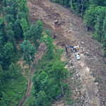
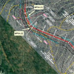
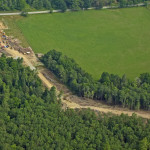
UPSHUR COUNTY: 6/8/18
-
- MP34 (1)

-
- MP34 (2)
-
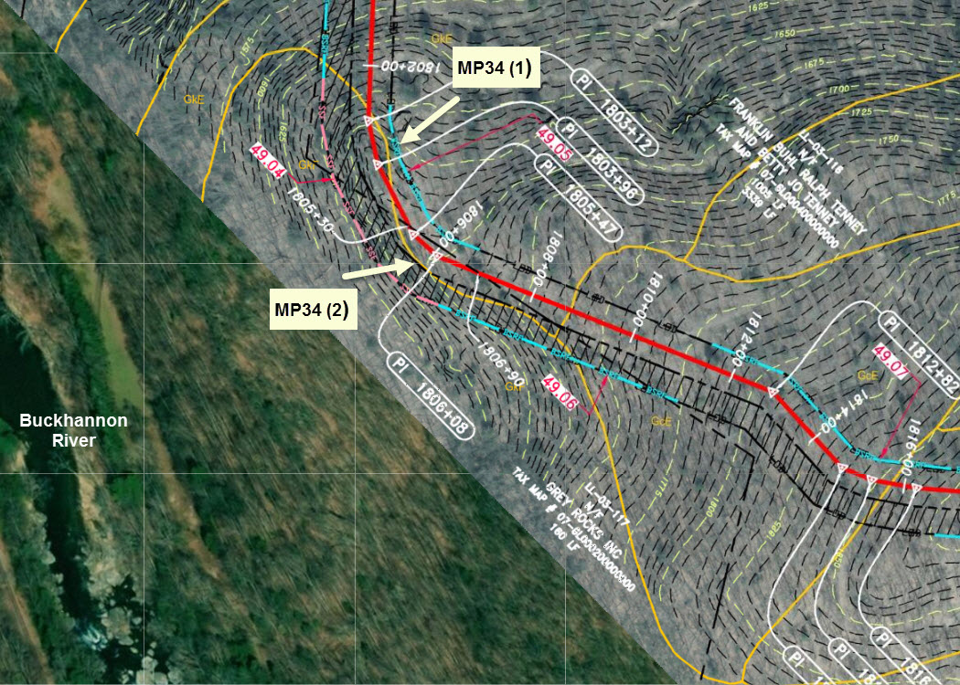
- Location Map
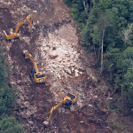
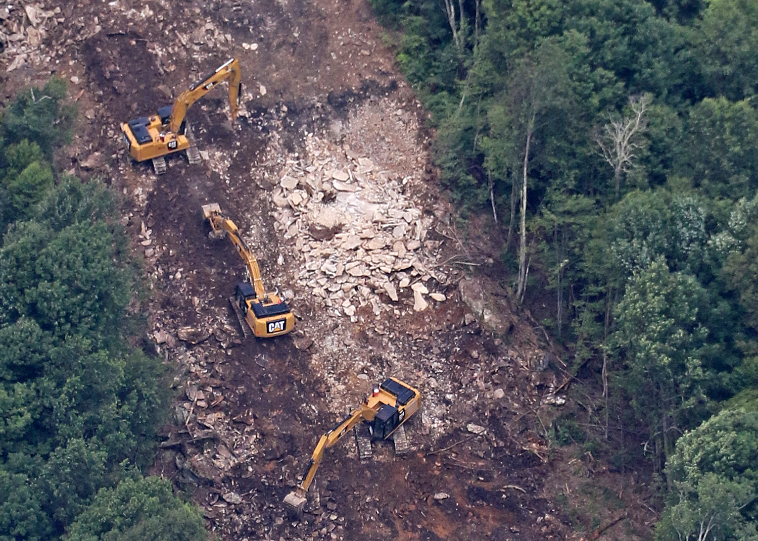
Early-stage ACP construction activity in the Milepost 34-35 area approximately 600 feet up-slope from the Buckhannon River in Upshur County. Tree removal has been completed and rough grading and excavation are underway. The required perimeter controls, the Belted Silt Retention Fence and Super Silt Fence shown on the Construction Alignment Sheet, have not been installed. Slopes exceeding 40% are present in this area.
Location map: Screenshot from the online CSI Mapping System, indicating the location of the photos, MP34 (1) and (2) in relation to plan details shown in Construction Alignment Sheet 49. The red line indicates the location of the pipeline trench. The blue and pink lines along the indicated Limits of Disturbance (LOD) indicate the designated locations for installation of Belted Silt Retention Fence and Super Silt Fence.
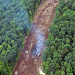
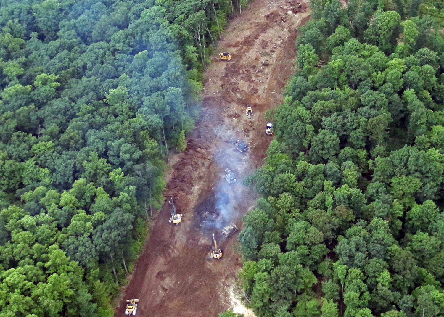
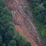
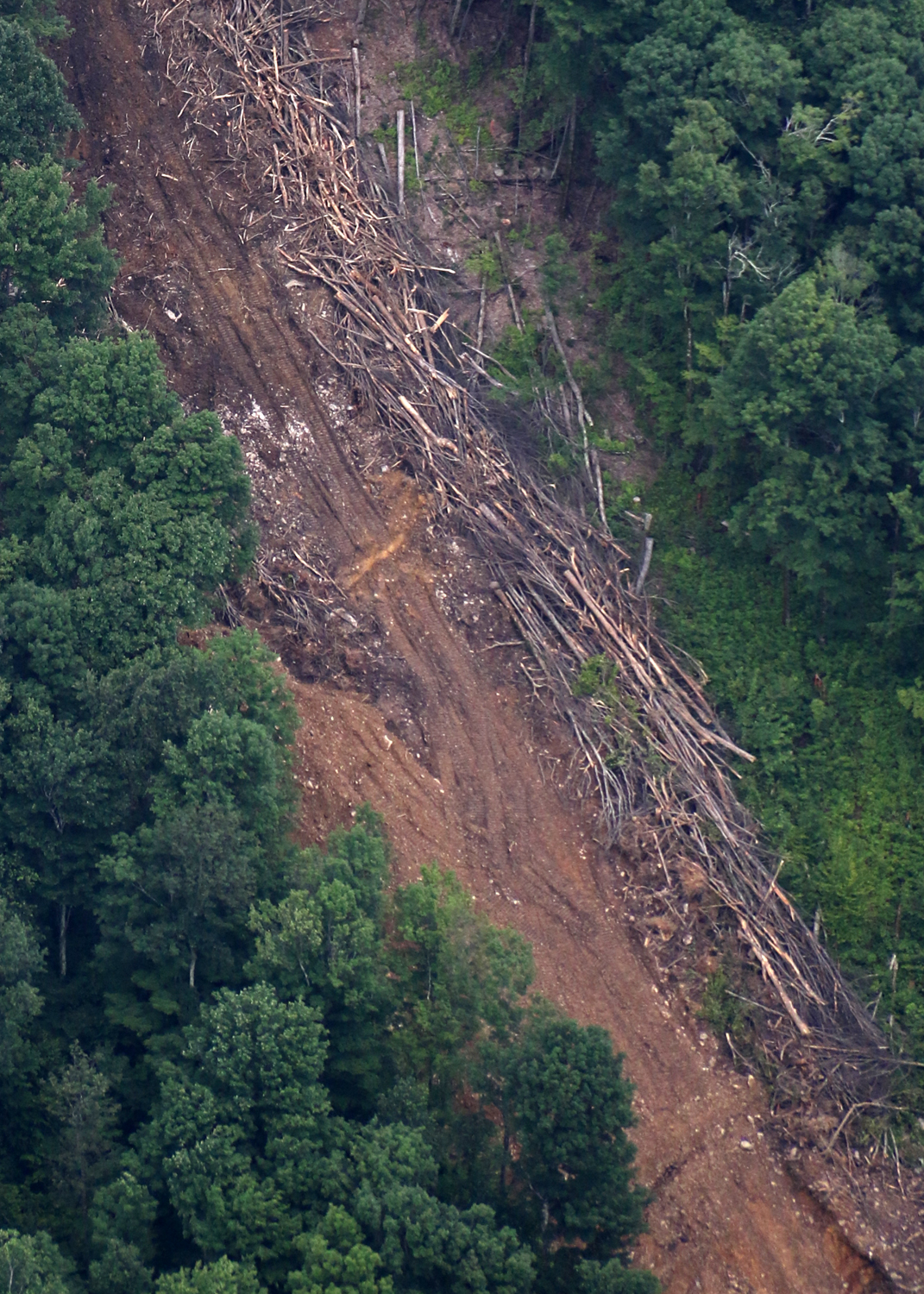
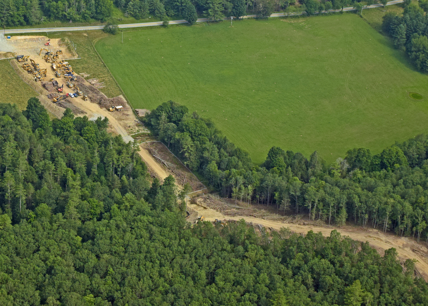
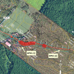
RANDOLPH COUNTY: 6/28/18
-
- MP60 (1)
-
- MP60 (2)
-
- Location Map
Early-stage ACP construction activity in the Milepost 60-61 area up-slope of Valley Fork of Elk River in Randolph County. Tree removal and excavation are underway without installation of perimeter controls shown on the Construction Alignment Sheet. Slopes range from 30% to greater than 60%.
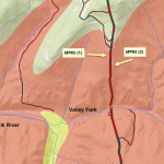
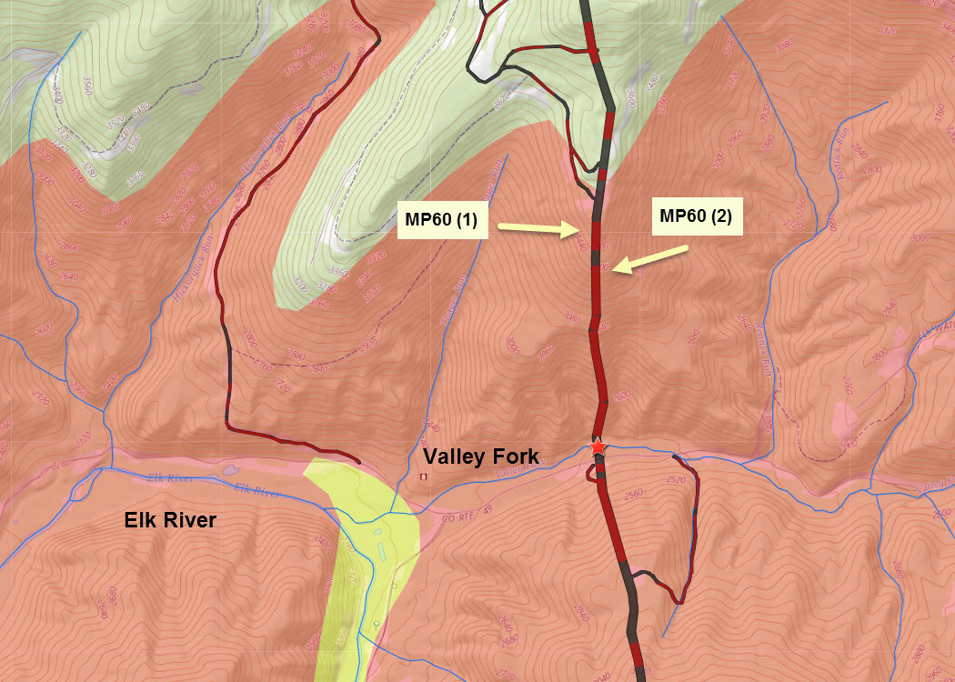
Location map: Screenshot from the online CSI Mapping System, indicating the location of the photos, MP60 (1) and (2). The pipeline corridor and access roads are shown as black or red lines, with red indicating slopes exceeding 30%. The red star indicates proposed in-stream blasting. The extent of the Mauch Chunk geologic formation, which is associated with extreme erosion and landslide potential, is shown in pink. Previous earth-disturbing construction activity in Mauch Chunk areas has resulted in protracted downstream sedimentation impacts. Valley Fork and Elk River are both trout streams.
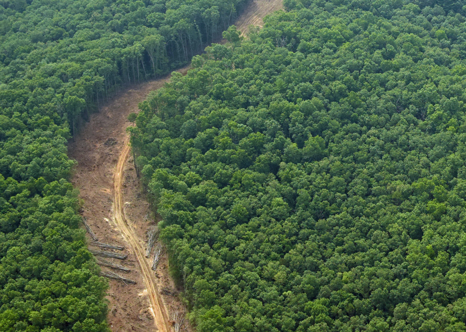
POCAHONTAS COUNTY: 7/15/18
-
- MP93 (1)
-
- MP93 (2)
-
- Location Map

Early-stage ACP construction activity in the Milepost 93-94 area at Thomas Creek and Seneca State Forest in Pocahontas County. Perimeter controls, including silt fence and compost socks are present at the Thomas Creek crossings but not up slope in the Seneca State Forest area, where tree clearing, steep-slope equipment use, and initial grading is underway.
Location map: Screenshot from the online CSI Mapping System, indicating the location of the photos, MP93 (1) and (2) in relation to plan details shown in Construction Alignment Sheet 105. The red-shaded areas in the pipeline corridor indicate slopes that exceed 30%. The red stars indicate locations where in-stream blasting is planned. The blue lines along the indicated Limits of Disturbance (LOD) indicate the designated locations for installation of Belted Silt Retention Fence.